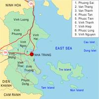
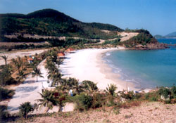
Khanh Hoa lies on the coast of Southern Central Vietnam, with the mainland part protruding farthest into the East Sea.
The province is bordered by Phu Yen Province to the North at 12052’15"
N; Ninh Thuan Province to the South at 11042’50" N; Dak Lak Province
to the West at 108040’33"E; and the East Sea to the East at 109027’55"
E. To the farthest point, Doi Mount on the peninsula of Hon Gom, Van
Ninh District is the easternmost mainland point to the East of the
Socialist Republic of Vietnam.
Apart from the territory on the mainland, Khanh Hoa also has its
territorial waters, continental shelf, inshore islands and the island
district of Truong Sa.
Nha Trang - Khanh Hoa is 1280km from Hanoi, 535km from Danang, 448km from Ho Chi Minh City.